


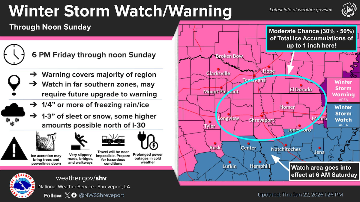
Updated: The entire Four-State region is now under either a Winter Storm Watch or Winter Storm Warning as a significant winter storm is poised to impact the entire region this weekend. A combination of freezing rain, sleet, and snow can be expected with this event.
January 22, 2026 - The National Weather Service, Shreveport, Louisiana issued an Winter Storm Watch at 12:00 noon on Tuesday, January 22, 2026 for Shelby County, Texas. Winter Storm Watch is in effect from Saturday morning through Sunday morning.
WHAT... Heavy mixed precipitation possible. Total snow and sleet accumulations up to one inch and ice accumulations between three tenths and three quarters of an inch possible.
WHERE... Portions of north central and northwest Louisiana and east Texas.
WHEN... From Saturday morning through Sunday morning.
IMPACTS... Expect power outages and tree damage due to the ice. Travel could be impossible.
Precautionary / Preparedness Actions: Monitor the latest forecasts for updates on this situation.
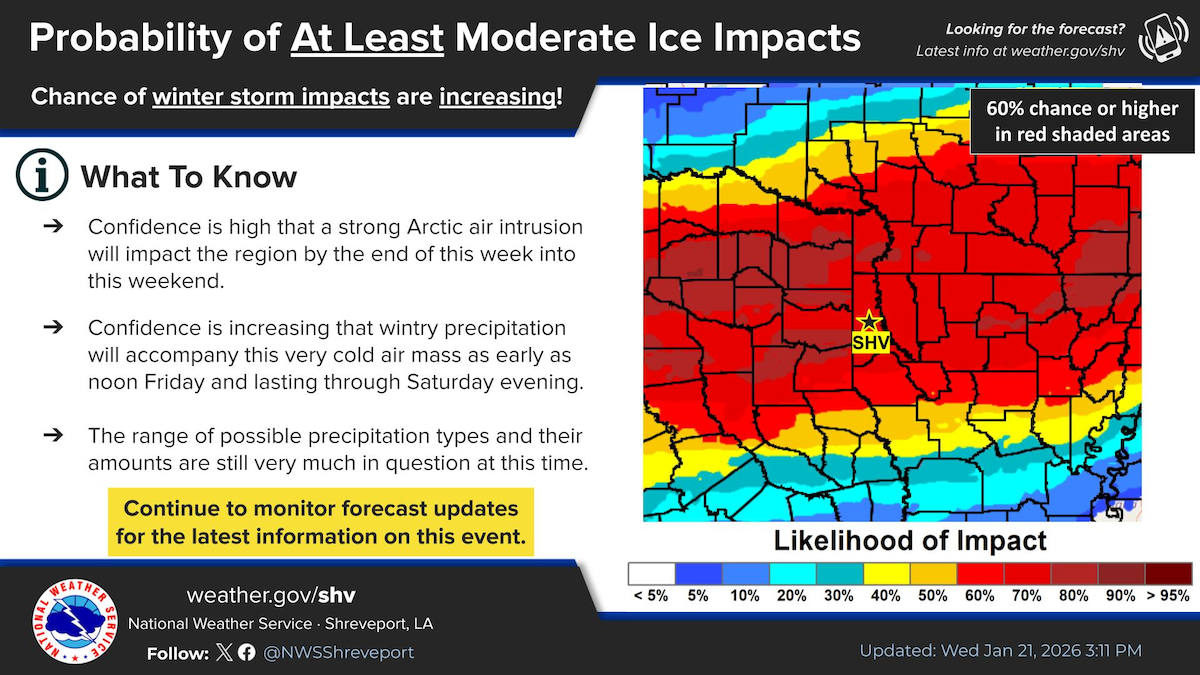
Chances of at least some moderate impacts are increasing with an expected winter storm by the end of the week into this weekend. There still remains some uncertainty with precip types and amounts, so stay tuned for the latest information on this forecast!
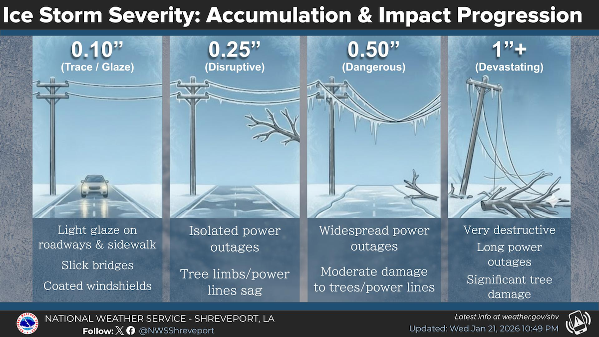
It only takes a quarter of an inch of ice accumulations to start bringing down tree branches which could lead to power outages. For reference, some models are showing between a half to one inch of ice accumulation for portions of the area.