



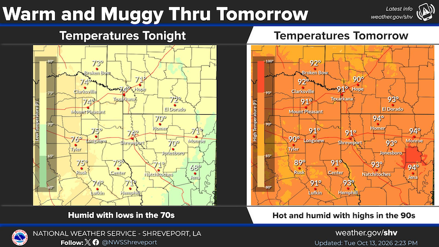
October 12, 2026 - Muggy conditions will continue through tomorrow, October 14, 2026 with lows in the 70s tonight and highs on Wednesday in the 90s.
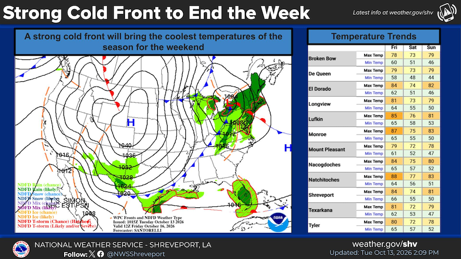
A strong cold front will bring the coolest temperatures of the season to the area on Friday, October 16 and continuing through the weekend. The coolest afternoon will be Saturday with highs in the 70s and the coolest night will be Saturday night with lows in the 40s and 50s.
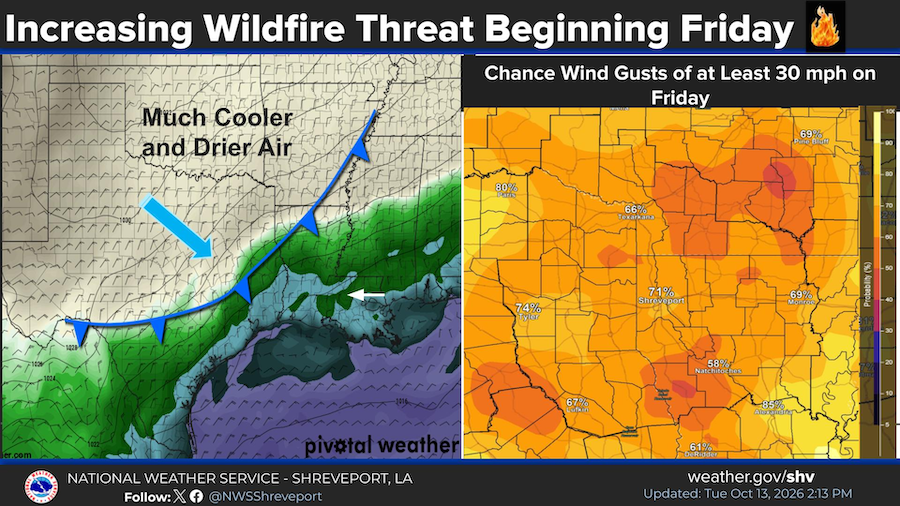
A strong cold front will bring much drier conditions to the area late this week and through the weekend with relative humidity values dropping between 20 and 30 percent and winds gusting out of the north up to 30 mph at times. This will increase the threat for fires.
Detailed Forecast
- This Afternoon - A 50 percent chance of showers and thunderstorms. Partly sunny, with a high near 91. Heat index values as high as 102. South wind around 10 mph.
Tonight - A 30 percent chance of showers and thunderstorms before 7pm. Increasing clouds, with a low around 73. South wind around 5 mph. - Wednesday - Partly sunny, then gradually becoming sunny, with a high near 91. South wind 5 to 10 mph.
Wednesday Night - Mostly clear, with a low around 65. South wind around 5 mph becoming calm. - Thursday - Sunny, with a high near 90. Calm wind becoming southeast around 5 mph in the afternoon.
Thursday Night - Clear, with a low around 64. - Friday - Sunny, with a high near 83.
Friday Night - Partly cloudy, with a low around 52. - Saturday - Sunny, with a high near 72.
Saturday Night - Mostly clear, with a low around 47. - Sunday - Sunny, with a high near 78.
Sunday Night - Partly cloudy, with a low around 55.