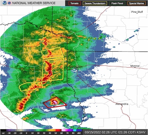
March 14, 2022 - At 1100 PM CDT, Doppler radar was tracking strong thunderstorms along a line extending from near Stonewall to near Logansport to near Patroon to 7 miles southwest of Rosevine. Movement was east at 45 mph.
HAZARD...Winds in excess of 40 mph and half inch hail.
SOURCE...Radar indicated.
IMPACT...Gusty winds could knock down tree limbs and blow around unsecured objects. Minor damage to outdoor objects is possible.
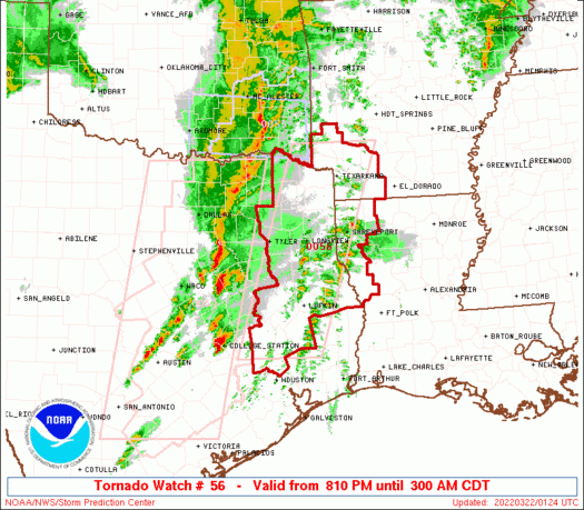
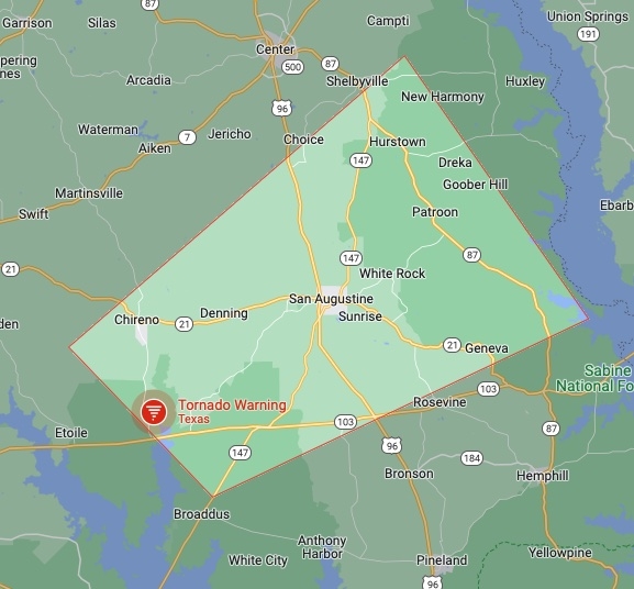
March 14, 2022 - The National Weather Service, Shreveport, LA issued a severe weather statement at 9:33pm Monday, March 14, 2022. A tornado warning remains in effect until 10pm CDT for Southeastern Nacogdoches and West Central San Augustine Counties.
January 19, 2022 - The National Weather Service Storm Prediction Center in Norman, OK, issued a Severe Thunderstorm Watch (WS 16) at 1:05pm CST on Wednesday, January 19, 2022.
January 19, 2022 - The National Weather Service issued a hazardous weather outlook at 5:19am CST on Wednesday, January 19, 2022.
This Hazardous Weather Outlook is for portions of south central Arkansas, southwest Arkansas, north central Louisiana, northwest Louisiana, east Texas and northeast Texas.
December 29, 2021 - This Hazardous Weather Outlook is for portions of south central Arkansas, southwest Arkansas, north central Louisiana, northwest Louisiana, southeast Oklahoma, east Texas and northeast Texas.
Day One: Today and Tonight
Thunderstorms will be possible across the I-30 corridor into south-central Arkansas later this morning into early this evening. Some severe storms may be possible producing hail, damaging winds, and isolated tornadoes.
October 27, 2021 - The National Weather Service of Shreveport, Louisiana at 10:05am issued a Tornado Watch outline update. Tornado Watch 541 is in effect until 4:00pm CDT for the following Texas counties: Harrison, Marion, Panola, and Shelby.
At 9:31am CDT, the National Weather Service issued the following Special Weather Statement.
A strong thunderstorms will impact portions of south central Panola, southeastern Rusk, Nacogdoches, Shelby, Angelina and San Augustine Counties through 10:30am CDT.
June 8, 2021 - At 11:15am on Tuesday, June 8, 2021, the National Weather Service in Shreveport has issued a Severe Thunderstorm Warning until noon. At 11:14 AM CDT, severe thunderstorms were located along a line extending from Pinehill to near Garrison to Nacogdoches, moving east at 35 mph. Radar indicated 60 mph winds gusts which can cause damage to roofs, siding, and trees.
June 7, 2021 - The National Weather Service issued a Severe Thunderstorm Watch at 12:30pm on Monday, June 7, 2021. Watch 242 is in effect until 7pm for the following Texas counties: Angelina, Bowie, Camp, Cass, Cherokee, Franklin, Gregg, Harrison, Houston, Jasper, Madison, Marion, Morris, Nacogdoches, Newton, Panola, Polk, Red River, Rusk, Sabine, San Augustine, San Jacinto, Shelby, Smith, Titus, Trinity, Tyler, Upshur, Walker, and Wood.